Training on atmospheric dispersion in urban environment
8. Application of the CUDM System to hypothetical scenarios in some Canadian cities
MONTREAL
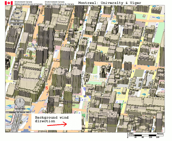
Downtown Montreal - Scenario 1: Plume dispersal calculations by CUDM for a release source located at University and Viger Streets. Buildings have an impact on both lateral and vertical dispersion close to the source and immediately downwind. Enlarge the animation.
;)
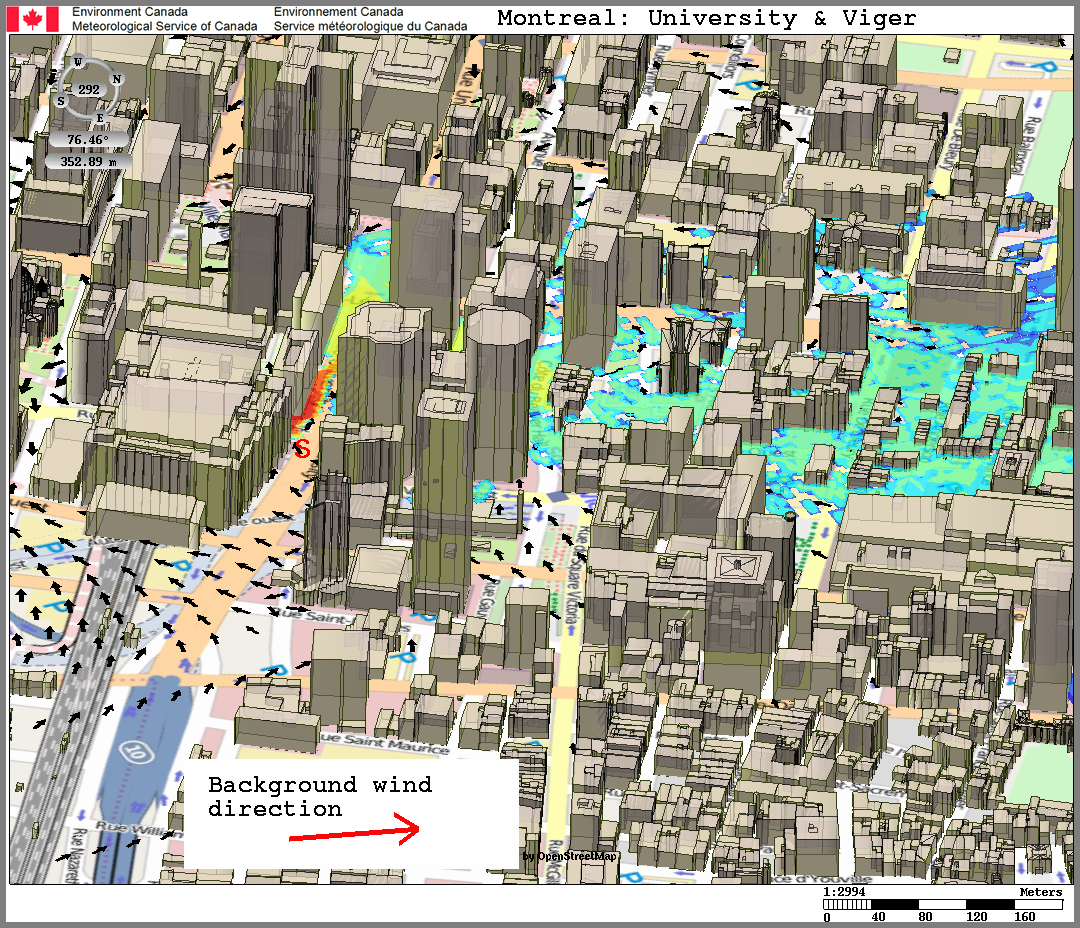
Downtown Montreal - Scenario 1: Concentration at ground level with surface wind superimposed. Warmer colours indicate higher relative concentrations of dangerous material, with each colour level representing a change in concentration by a factor of 10. The source (red S) is located at University and Viger streets. The above-roof-level wind (red arrow) is from the southwest, oblique to University street, but at street level the prevailing wind is deflected by the buildings. Consequently the low-level plume is shifted off the central axis of the undisturbed wind, and is channeled to the northwest along University street. Enlarge the figure.
;)
;)
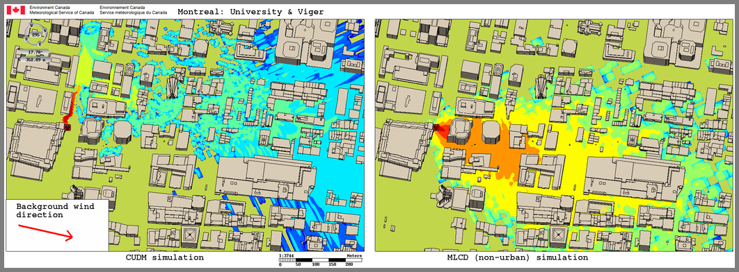
Downtown Montreal - Scenario 1: Concentration at street level: warmer colours indicate higher concentrations. On the left: plume dispersion simulation with CUDM (including buildings). On the right the same scenario simulated by MLCD (without buildings effects). This figure illustrates the importance that low-level channeling can have on longer range plume transport. As shown, the ground level concentrations are significantly displaced from one another. With the prevailing wind from the southwest, the case without buildings shows the plume traveling northeastward leading to higher risk zones (red areas) northeast of the release point on University street. When the impact of buildings is taken into account, the plume first gets channeled to the northwest, and then once the material gets above rooftop level it travels northeastward with the prevailing wind. The high risk zones are now in a completely different place, along the University street northwest of the release point. Enlarge the figure.
;)
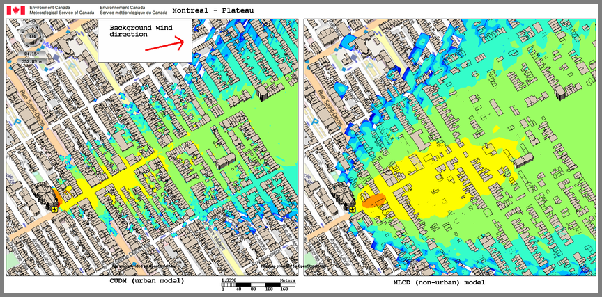
Montreal - Plateau MontRoyal District - Scenario 2. In this area, the mean height of buildings is about 10 metres. The ground-level concentrations from CUDM (with building effects) is similar to that obtained by MLCD (without buildings effects), but narrower. Channeling near the release point deflects the higher risk zones (red-orange color) of the CUDM simulation to the northwest. However, the material reaches the lower rooftop level - and the prevailing southwesterly wind - relatively close to the release point, and thus there is less change in the plume's central axis, compared to the downtown scenario with taller buildings. Enlarge the figure.
<< Previous | >> Next;)